Envision Alewife–FPRA Concerns

FPRA Comments submitted May 31, 2017

To: Cambridge City Council, Planning Board, Community Development Department, Envision Team

Re: Concerns regarding Alewife Envision Planning Process

Dear Cambridge City Officials and Envision Team,

The Fresh Pond Residents Alliance, the neighborhood group that includes the Alewife planning area, supports the need for comprehensive planning of the Alewife area. We are concerned, however, that the scenarios and plans being developed through the Envision planning process do not represent the best interests or concerns of the Alewife area residents, nor of the city as a whole. We raised many of these concerns in our letter of 2/1/17 (attached), to which we have received no response. Our members have strongly expressed their concerns several times at both FPRA public meetings and Envision public meetings. Although every Alewife Envision Working Group and public meeting begins with a review of the vision statement, the plans presented clearly do not meet this vision. We support the goal that Alewife provide significantly more housing and economic opportunity than at present within various real constraints, including the area being subject to severe flooding as soon as 2045, the date at which the 100-year storm is predicted to outflank the Amelia Earhart dam.

Our first concern is that the proposed scenario and accompanying zoning changes will degrade the sustainability, social interactions and safe connections of the area. While we have repeatedly asked to see scenarios that have a lower density than the current zoning allows—which is itself a major increase in density over the 2004 status quo—we continue to be presented with plans that have significant increases in density.  At the public meeting held by Envision on 2/8/17, the audience clearly supported seeing a lower density scenario. At the FPRA public meeting of May 24, the participants reiterated this position.

The “middle-of-the road” proposal presented at the Envision Alewife Working Group meeting of 4/27/17 still showed an increase in density—from 1.3 FAR to 1.56 FAR. The impacts—which is what matters in the end— were presented only for the 60% build-out, and were particularly worrisome in the case of traffic on Concord Ave. These impacts were obviously an underestimate of the final impacts at 100% build-out.  It may be argued that 100% build-out is a long time off. However, what we have seen at Alewife is, to the contrary, that construction has far outpaced the expected rate of development laid out in the 2005 planning scenarios.

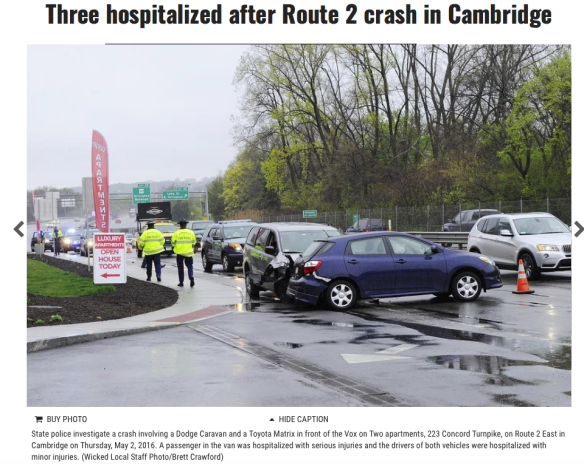
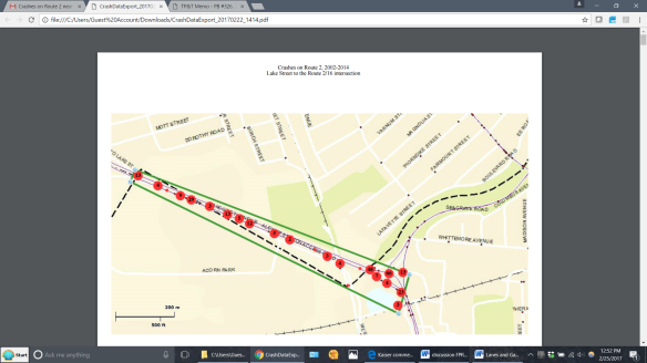
According to the presentation of impacts, existing quadrangle peak traffic on “Outer Concord Avenue” is already about 800 cars on top of the 500 cars that are from non-quadrangle traffic (slide 45). That can hardly be blamed on through-traffic to Boston.  The proposed “New combined scenario” adds another 500 or so cars on top of the current existing 1,300 (approx.). But that is at only 60% of the build-out, so it underestimates the impact not only on that section of road, but on the Blanchard intersection and residents in Cambridge/Belmont at one end, and the entire Fresh Pond Parkway rotary system at the other end.

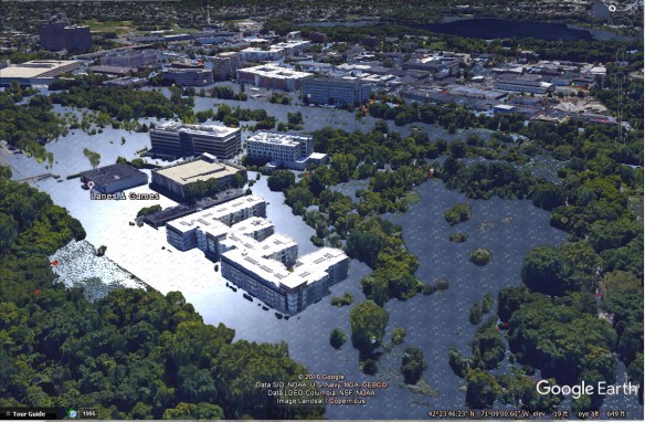
In addition, several projects under active discussion with the City and residents have been omitted:  55 Wheeler Street, despite the developer having been engaged in active discussions with CDD since at least August of last year, is not included. This project is proposed as 530 units. The map also fails to include 605 Concord Ave. (49 units already permitted) and Fawcett Street (44 units currently under construction).  Why does this matter? 55 Wheeler St. includes one of the proposed green spaces shown on page 22, as well as the frequently discussed bridge landing. 55 Wheeler Street also includes three new streets shown on page 23, one of which their current project design would render impossible. On page 37, there is a map labelled as “Housing Units- Existing and Pipeline.” None of the 3 projects mentioned are included on the map, and, therefore, the baseline figures on page 36 appear much lower: the current housing situation totals 697 units, 98 of which are still to be built. In fact, the real numbers are 1,320 units, 721 of which are still to be built. This allows them to show a rosier picture on page 36. The bar graph for the New combined (preferred) scenario shows a housing total of 1,777 units at 60% buildout. The real number will be 2,400, by our count. This will in turn affect the traffic calculations.

We have, thus, a fundamental question. At what point, or by whom, was it decided that the Alewife area should increase its density above the already high increase allowed in 2005?  Why is this being relentlessly pursued with no explanation, as if it were a foregone conclusion? The Envision “New combined scenario” has a painfully small amount of open space proposed for public use. But at the proposed density there is nowhere to expand the public open space to. As property values continue to relentlessly climb, the City needs to take action now to secure open space and tackle the mobility and traffic issues head-on. May we state the obvious that making more intersections F-rated is not acceptable?

Our other grave concern is that the entire development of the quadrangle so far depends on one-sided access—Concord Avenue—forming a near cul-de-sac for thousands of residents and workers, while simultaneously claiming to be transit-oriented and maximizing the opportunities for sustainable transportation. The refusal of CDD and the consultant to even show the necessary bridge across the T tracks to link the area to the Alewife station is makes the area unworkable. To say that it can’t be shown because some other more important investment could prevent it from being built, may be too close to the truth. But it is important to make this area function reasonably well while we still can. We are well aware that features not shown on a plan will simply not happen. We learned that from the 2005 Alewife plan.  As we asked in our February 2017 letter, there must be a commitment to invest in the infrastructure that will make this development work. Waiting until after the development has occurred is a recipe for failure—which the residents will have to live with for years to come.

There are several things to like about the “New combined scenario” that was presented at the Working Group meeting. The presentation of the housing, jobs and tax/fiscal impacts were also helpful, albeit for only 60% build-out.  The improved street grid, mix including light industrial, commercial, and owner-occupied townhouses that would help stabilize the neighborhood, together with creative structural approaches to inevitable flooding, hold promise. However, this will not work at the density proposed. It will not result in a livable Alewife community and will have serious negative impacts on neighboring streets and communities. At a lower density there could be reasonably-sized public open green spaces, stormwater treatment, and transportation linkages that could double as emergency access and egress during flooding without sacrificing a major increase in residential and economic development.

We respectfully ask the City Council and Community Development Department to require a lower density scenario with the necessary infrastructural investments be developed and presented to the public. We also ask that a serious multi-stakeholder Alewife Mobility Task Force be established by the City, similar to what exists in Kendall Square, including the Alewife TMA, community groups and others. This Task Force should report back to the City Council with proposed actions and within a defined timeframe.

We look forward to your response and continued dialogue regarding development in Alewife.

Yours sincerely,

Fresh Pond Residents Alliance Board

Doug Brown, Standish St.
Terry Drucker, Chilton St.
Alison Field-Juma, Concord Ave.
Alice Heller, Corporal Burns Rd.
Langley Keyes, Chilton St.
Peggy Barnes Lenart, Fayerweather St.
Mike Nakagawa, Madison Ave.
Ovadia Simha, Blanchard Rd.
Arthur Strang, Fresh Pond Pkwy.
Ann Sweeney, Lakeview Ave.
Jay Yesselman, Vassal Lane

Reply to: freshpondresidents@gmail.com

Advertisement

Come to a Neighborhood Meeting of the Fresh Pond Residents Alliance

Weds. May 24th, 6:30-8:30 pm at Tobin School

Get the latest information and vote on important issues.  A strong Neighborhood voice makes a difference! 

alewife2070flood_googleEarth_light

Projection of Alewife Flooding at Lanes & Games from Cambridge Climate Change Vulnerability Study data.

While the likelihood of flooding increases in our area, development is accelerating in the floodplain. And if you think traffic can’t get worse, think again. Come evaluate the 530-unit development at 55 Wheeler St. (formerly Abt).  Hear concerns about the Envision Cambridge planning process in Alewife. Make input into neighborhood positions.  

AGENDA

6:30 Current development reports:

  • Lanes & Games
  • The latest Tokyo proposal
  • Envision Planning in Alewife–major concerns about the process, discuss FPRA actions
  • Water main replacement and water quality impacts, discuss FPRA position
  • Your neighborhood issues

7:15  55 Wheeler Street (former Abt Assocs., behind Trader Joe’s)

  • Presentation of proposed 530-unit residential development
  • Question & Answer session
  • Member deliberation

8:30 Adjourn

City Council Approves 20% Inclusionary Zoning!

On April 3 the Cambridge City Council unanimously voted to increase the inclusionary housing requirement to 20%! This is the first increase in 19 years, and will significantly increase the new affordable housing available in Cambridge.

Congratulations to Cambridge Residents Alliance which has been pushing for an increase for years. Thanks also to Black Lives Matter Cambridge who stood up visibly and vocally for this change. We all wish this had been done years ago, so that we could have prevented the displacement of many Cambridge residents. This change, however, should be celebrated and we thank the City Council for making it a reality.

Cambridge Residents Alliance had called for a number of changes in the proposal, and most of them were approved, including:

  • Removing language that excludes existing Planned Unit Developments (PUDs) from the 20% Inclusionary requirement
  • Preventing developers’ goal of providing a lower amount of affordable units;
    requiring 3-bedroom units
  • Requiring affordable units in smaller buildings
  • More frequent review
  • An earlier full implementation date, and
  • No further increases in density.

City Councilors passed the ordinance with these change because they listened to all of you who spoke during public comment, made calls and sent emails. Thank you! We also aim to press for 20% for low-moderate income people and 5% for middle income people, as CResA called for, at the time of the annual review. FPRA will work with CResA for even more affordable housing measures.

For more information and analysis see: Cambridge Day and Cambridge Chronicle. (The Chronicle story is good but has some errors. 1) The requirement starts now, and 2) in effect, the requirement is now 11.5%, and will be raised to 15% now and 20% at the end of June.)

Comments on Inclusionary Housing Petition

Date: March 25, 2017

To:    Cambridge City Council

Dear Mayor Simmons and Cambridge City Councilors,

The Fresh Pond Residents Alliance strongly supports the petition before the Council to increase the required inclusionary housing to 20% of all units.  While we support a rate of 25%, we feel that the increase to 20% currently being considered by the City Council is significant and should be adopted as an interim step, with the ultimate goal of 25%.

This is an urgent matter. The foregone affordable housing due to the current low inclusionary rate is a great loss. The Alewife area is the site of rapid construction of large luxury rental residential buildings, already exceeding the city’s own planning projections. Over the past 6 years, the higher 20% percentage would have yielded an additional 201 units on top of the 397 affordable units already developed or in the immediate pipeline.

We also strongly believe that the new higher rate should be applied to Planned Unit Developments (PUDs) throughout the city, both existing–when special permit amendments are proposed–and future.  The FPRA would like to again emphasize the urgency of the need for more affordable housing–every possible opportunity should be used to apply the 20% standard to existing PUDs. The sheer number of inclusionary units that this one act will create–212 affordable homes at North Point alone–cannot in good conscience be ignored; the number of inclusionary units coming out of other development proposals pale in comparison.  Other large PUD developments, like MXD in Kendall Square, are providing 25% affordable housing, which shows that it is economically feasible.

We are concerned that Cambridge is becoming a divided city, a city of those who can afford the high market rate housing (owned or rental) and those who qualify for subsidized housing. The middle is disappearing, and we see that only too clearly in our own neighborhood. Inclusionary housing should include housing for the middle income as well as low income residents. This may need to be an add-on to the 20% as it will assume somewhat higher rents, but we need to avoid just building for the extremes.  The housing that is being built should also include home ownership options to encourage a more stable population. The current trend of rapid expansion of luxury rental housing is undercutting the qualities we all say we cherish in our city, of diversity, equity and a sense of community.

The FPRA also strongly supports the provisions in the proposed ordinance that requires: three-bedroom units, affordable units in smaller buildings, more frequent review, an earlier full implementation date, and no further increases in density.

We therefore ask the City Council to:

  1. Remove the PUD exclusion language from the proposed ordinance.
  1. Assert that major amendments to a PUD’s special permit should trigger the application of 20% Inclusionary housing.
  1. Ask that the City require 15% affordable Inclusionary housing in existing PUDs starting now.  This change would result in 87 additional affordable units at North Point.
  1. Add the new language that allows lower rent levels for Inclusionary tenants who have lost income and allows flexibility for poor credit.
  1. Add the new language stating that the City Manager promulgates Inclusionary regulations and that there will be a 30 day review with a public meeting.
  1. Ask the Community Development Department to propose to the Council how the City can increase the amount of middle income affordable housing.

Thank you for considering our comments. Please don’t hesitate to contact the FPRA Board if you have any questions.

Climate Change Preparedness & Resilience Planning for the Alewife/Fresh Pond Area Public Meeting

Wednesday, April 12, 6:00-8:00 pm

West Cambridge Youth Center, 680 Huron Avenue

The City will present findings from the Climate Change Vulnerability Assessment for the Alewife/Fresh Pond area and discuss strategies to increase preparedness and resilience.  Alewife/Fresh Pond is an initial focus for the Climate Change Preparedness & Resilience (CCPR) Plan that is in development.  The Climate Change Vulnerability Assessment – Part 2 summary report, which focuses on the risks from sea level rise and storm surges, has been posted on the CCPR project webpage.

FPRA Comments on Special Permit Application for 195 & 211 Concord Turnpike (Lanes & Games)

Image

UPDATE: The Cambridge Planning Board’s continued public hearing on this project has been scheduled for Tuesday, April 4, 8 pm, at City Hall Annex, 344 Broadway (corner of Inman). 

The Fresh Pond Residents Alliance provided these written comments to the Cambridge Planning Board on the proposed new residential development of 320 units at the Lanes & Games/Gateway Inn property on March 4, 2017. The first Planning Board Hearing was held on February 21, 2017, and was continued to an undefined date. Application documents are available here.

FPRA has serious concerns regarding this project. It is a redevelopment of a currently low-density commercial site that is not only within the current 100-year flood delineation but within the floodway itself. It is in the worst part of the whole Alewife area in terms of flooding.  The City’s climate change vulnerability assessment shows that this site will be the most affected of any site in the Alewife area. In the application, BSC notes 2030 100-year elevation as 7.46 NAVD. It appears that Flood Elevations associated with the 2030 and 2070 100-year storm events have been provided by the City to the Applicant but not to the Planning Board. From the information available, we conclude that there will be significant flooding every five years, on average. We support Mr. Russell’s request to see the actual flood levels expected at the development site with information on where the flood waters will come from. This should be for current, 2030 and 2070 timeframes. Our specific concerns are as follows:

  1. The project is presented with no context information from the applicant or CDD. We believe it is only by seeing the cumulative effect of each project that the Planning Board can properly assess the impacts. The Alewife area is developing extremely rapidly and has many serious problems, including traffic, mobility and lack of infrastructure. It is not possible to assess the incremental negative effects, and their relative importance, without this context. The CDDE or applicant should provide: current and planned development changes in population, population of children, affordable housing units, percent open space (green and publicly accessible, and housing turnover rates—especially of rentals in this area. The CDD should show the cumulative effect of each project on transportation and circulation , additions to the housing stock, implications for public services, and usable open space for the entire area.
  2. Housing is not an acceptable use of this site because it:
  • Puts people in harm’s way due to the extreme flooding it will experience. It would be inaccessible to Cambridge fire trucks, ambulances, and other emergency services during flood events. These conditions would place people at serious risk. The DPW memo of 2/15/17 asserts that the building has been designed “to minimize damage and recover from the 2070 100-year flood event,” but this logic does not apply to the people living within it.
  • Residents who are low to moderate income have fewer financial resources to draw on for weathering flood conditions and property damage (e.g., loss of vehicle) and to relocate when the area floods or afterward. The people selected for affordable units don’t have the same options for balancing the risk of living in the worst part of the flood zone as people with financial means.  If they are selected for a unit, they will jump at the opportunity compared to the possibility of being flooded and the potential danger.  But some people will be on the wrong side of the gamble. The market-rate housing will be primarily transient wealthier people who can exercise options, such as leaving the area for higher ground in a hotel.  They may have family nearby, which is less likely for immigrant families. This is a problem of environmental justice.
  • The area is jammed by failing traffic intersections during rush hours. How would school buses access the site for the children living there? Out of 320 units, how many would have children? The sidewalks being provided along the Rte. 2 highway have no protection from speeding cars—wouldn’t children be walking here?
  • Parked cars that are in the floodplain would be irreparably damaged and would pollute the adjacent wetlands, waterways and Alewife Brook/Mystic River.
  • What kind of housing is being provided? The rental turnover rate is this area is very high, with tenants staying less than a year. One of the main predictors for resiliency in the face of weather extremes is community cohesion. Placing an essentially transient population in this zone would be unwise.
  • The air pollution from being so close to a high volume roadway that is heavily congested for much of the day would be a health hazard for people living there.  It would be inadvisable for the low-income housing families to have their kids play outside.  Small particulates (PM10, PM5, PM2.5) are particularly harmful.
  1. Traffic—Project Review Special Permit  (Section 19.20). This project will have “a substantial adverse impact on city traffic within the study area.” The project would make traffic incrementally worse by some 840 daily vehicle trips (according to the Traffic Impact Study (TIS)), in addition to the cars from Vox on 2, and from Cambridgepark Drive. The traffic presentation should include all traffic down thought the Fresh Pond rotary and the dates of the study’s data collection. We ask that traffic studies include measurement of peak traffic on peak days (non-school holiday, non-summer) of the year, not just peak hours. Up to the sites containing Vox on 2 and the proposed project, Route 2 is a limited-access 3-lane (eastbound) highway, and it has no acceleration/deceleration lane adjacent to the property. The TP&T Memo of 2/16/17 states that: “TP&T believes that the proposed driveways are reasonable. . . . According to the TIS there were, no crashes recorded at the Lanes & Games bowling alley and Gateway In driveways at Route 2 [sic].”  At the hearing the TIS study author stated that there had been no accidents at Vox on 2, immediately next door either. Clearly there have been many accidents there, as a shown in the atttached photo, and in the data sheet from the MASSDOT Crash Portal. This TIS is unacceptable.

Vox on 2 crash photo

Lands and Games crash data

Crashes on Rte. 2, 2002-2014 Source: https://services.massdot.state.ma.us/crashportal/

  1. Open space and public realm/ Building scale and massing. The developer has been adept at fitting as many units as possible onto the site despite its difficult shape. What is the justification for this density of development when it will result in so many negative impacts and provide housing that is squeezed between parking garages and a highway, with views of adjacent office buildings, garages and the congested highway (with its attendant air pollution) just feet away. This building density has left little room for public amenities or open space that would help to build the sense of community of which this site is devoid. If this site were used for housing, there is no street-level retail shown and people would presumably have to drive to supermarkets offsite to get food and other necessities. The proponent describes the development as an “urban village.” In what way does this development have features of such a village, such as public sphere, shops, playgrounds, etc.? The developer should present a design with lower density and a smaller building footprint.
  2. Environmental concerns. Is there any toxic contamination of the site—will excavation expose contamination that should be remediated or that might move off-site? Any cars parked within the flood zone will not only be destroyed by flooding, their fluids will leak into the water and contaminate Alewife Brook and surrounding areas. The likelihood of cars being parked during a flood is far higher for residential building than office buildings. What water conservation measures are taken for landscaping—will it require irrigation?
  3. According to the developer’s TIS study, the development will generate 1,006 daily transit trips. What has the City done to obtain increased transit capacity at Alewife?
  4. We support the strengthened Pedestrian and Bicycle Connection to Discovery Park described in the Traffic and Parking memo (item #4) and the Transportation Demand Management measures. We support the Transportation Mitigation measures outlined in the memo but the payments suggested should be increased significantly in order to adequately fund these measures now so that the work can proceed without further delay.
  5. The current use as a bowling alley has been a major community asset for generations. How many of us have been to children’s birthday parties there? Redevelopment in the Alewife should replace this asset with something that also creates community cohesion for the larger Alewife area as well as a particular building’s residents. While the proposed 2-lane bowling may be a nice amenity for the residents, would it be accessible to the public? Will they be welcomed in such a small-scale facility?
  6. City-wide urban design objectives. The CDD memo notes that the goal is to have Alewife “be a sustainable, resilient, mixed used district with convenient and safe connections within the neighborhood and to the rest of the city, along with amenities that support interaction and social ties among its residents.” (p. 5). This project should have amenities at the street level to provide for the residents’ immediate needs and to enliven the streetscape. These could include small retail such as a dry cleaner, food and convenience stores, etc.

Based on the foregoing we have two additional specific recommendations:

  1. The CDD be responsible for commissioning and presenting the TIS for each project, funded by the developer, as is done in many other communities. We ask that this be given serious consideration and the relevant policies/zoning rules be so amended.
  2. The Planning Board request a presentation of the most current version of the Cambridge Climate Change Vulnerability Assessment so that you can see the depth and extent of flooding and the extremity of heat waves expected in the city. This may help the Board see their important role in protecting public health and building resilience. The DPW report states that the buildings would comply with the City’s guidelines and survive flooding, but does not show the severity and breadth of the problems for the people who would live and work there that we will encounter in the future.

Thank you for considering our comments; we look forward to continued discussion. Please don’t hesitate to contact me or other FPRA Board members if you have further questions.

FPRA Comments on Envision’s Scenarios for Alewife

The FPRA submitted comments to the City’s consultant, Tim Love of Utile, on his presentation to the Alewife Working Group on Jan. 26, 2017. At least six FPRA members attended this meeting.This was Utile’s sixth presentation to the Working Group formed under the Citywide planning process called Envision. The Alewife area is the first part of the plan to be developed, both because development is already so rapid in our area, and to be a pilot for the rest of Cambridge. These meetings are open to the public and we encourage you to go to the next one: March 9, 6-8 pm (Water Dept. Lunchroom, 250 Fresh Pond Parkway–watch for venue change).

Utile’s next step is to present this to the public (that’s you!) at an Alewife Public Workshop on Weds. February 8, 6-8 pm at the Tobin School Cafeteria, 197 Vassal Lane.

We hope and expect that their presentation will reflect and respond to our comments below (submitted 2/1/17). We hope that you will read and think about them prior to the meeting. The presentation we saw is available here.

“These comments are the result of considerable concern and dismay at the contents of the presentation. The length of the presentation [72 slides] afforded the members of the Working Group, and particularly the other members of the public, very little time to fully discuss or react to the presentation. The fact that the room was so full that some people had to stand for the two hours attests to the interest in this process.

The FPRA grew rapidly in response to the widespread discontent of people in the Fresh Pond and Alewife neighborhoods to the seemingly thoughtless and rapid development taking place throughout Alewife that did not reflect the Concord-Alewife Plan developed in 2004-5. As a result of the energy expressed by hundreds of our neighbors and other neighborhoods, City officials realized a City-wide plan for future development was needed, and in the case of Alewife urgently enough to prioritize it. 

Most of us have lived in this area for decades, and many of us participated actively in the process resulting in the 2005 Concord-Alewife Plan which was the framework for major zoning changes. These changes resulted in a rapid increase in land value, high volume of land sales and changes in ownership, extremely rapid development of major residential complexes, increases in traffic, and few improvements to the relevant mobility or other public infrastructure in the Alewife area. We do not want to see a repeat of this experience; in too many ways the plan scenarios were not responsive to the concerns that have been expressed to the City by the Alewife neighborhood.

We appreciate Utile’s considerable work to present ideas in a useful way. We recognize that the presentation’s intent was to lay out some conceptual scenarios specifically for the area known as the quadrangle, and that these will be refined in the context of the realities of the whole Alewife area in subsequent work and presentations. We hope that our comments will clearly convey where we see positive ideas and, conversely, where changes in approach are needed. Our specific comments are as follows:

  1. Assumptions

Since all four scenarios equaled or exceeded the FAR of the buildout under current zoning, it appears that the City intends to see development at Alewife exceed the currently permitted density.  The justification provided for this was that an increased density is needed to provide enough tax income to the city to fully cover the cost of building the necessary pedestrian/bike bridge over the railroad tracks. This begs the question: When did our current buildout become a “baseline”? We find these assumptions unacceptable:

(1) Significantly more density at Alewife is beneficial (over the current buildout, which itself was a very sizable density increase agreed to via the zoning changes in the 2005 Plan).

(2) Important infrastructure will only be built if it comes at minimal cost to the City. If we want infrastructure like the bridge, open space or connecting roads, the cost must be borne by the community living in and around Alewife in terms of actual tax revenue and externalities (increased traffic and air pollution, decreased quality of life and property values). Infrastructure will be provided after all development is committed or completed, although this will severely restrict any opportunities to do so.

Alternatively, we support these assumptions:

(1) “Alewife should be a sustainable, resilient, mixed-use district with convenient and safe connections within the neighborhood and to the rest of the city along with amenities that support interaction and social ties among its residents.” (Slide 4, Utile Presentation, “Alewife Vision”)

(2) The City should invest in the necessary infrastructure prior to development in order to steer development in the right direction and secure valuable public amenities. There are many infrastructure projects that the City does without having new tax income in hand.

  1. What is the City’s budget projection (costs and revenues) for the build out and other scenarios?

If the driving justification for the development of Alewife is economic (tax base), we cannot adequately weight the cost and benefits of any scenarios without knowing (roughly) the balance between new tax revenues and the needed investment in public amenities and infrastructure, including schools, roads, bridges, land and easement purchases, etc. Our conservative estimate of property tax revenue currently generated by new construction permitted under the Concord-Alewife Plan zoning is at least $8 million per year. With additional projects already in the development pipeline, this number will soon rise to roughly $11 million per year. This revenue stream is enough to support a sizeable bond issue which could in turn fund long-promised infrastructure improvements now, without needing to wait for any further new development. Tax increment financing should be one of the options evaluated and discussed.

  1. Density

The buildout density of the quadrangle is based on the zoning changes approved through the 2005 Alewife Planning process. Although there were obvious flaws with the implementation of that plan, there was general consensus that increasing density in Alewife made sense—up to a point.

Central Square was provided as the point of comparison. At no time in the planning process to date have we ever heard that a density equivalent to Central Square was desirable or even conceivable. Central Square has a fully developed street grid with many ways in and out of the density, it has a Red Line station and many bus lies in its center. Conversely, the Alewife quadrangle has no effective street grid and barriers on all four sides (Fresh Pond, FP Parkway, railroad tracks, the Highlands neighborhood). The “Mixed-use Commercial” scenario with high rise overlay is 2.64 FAR, even exceeding Central Square’s FAR of 2.2, and double the current buildout FAR of 1.3. The fundamental question of whether we should be putting more development in an area prone to flooding must be discussed. At what cost to residents, businesses and the City will future flooding come? The City has stated its commitment to building a sustainable and resilient community—that also includes not building in areas where it is unwise. We ask that you present:

(1) At least one additional scenario for the quadrangle that is significant down-zoning, with FAR between the current 0.6 and buildout of 1.3.

  1. No value attached to public open/green space

The “Environment” metrics used to describe the four scenarios were water use, flooding resilience, energy use, and solid waste/contaminant remediation. These are important metrics. But there was no mention of green space or open space that is needed to: make a pleasant public (and private) space, take pressure of Fresh Pond Reservation by providing a neighborhood park/square, reduce the heat island effect through green space and trees, support the biodiversity of the area (particularly songbirds and raptors), provide adequate space for green infrastructure to filter polluted stormwater, and enhance community life and connections which build resilience. The scenarios should:

(1) Add significant green space, differentiating between public and private space.  The “network of green infrastructure” idea is good—but the amount was insignificant.

(2) Show the % change in green space with each scenario. What is the quality of that greenspace (ecological richness)?

(3) Provide a metric for street tree cover, also showing % change with each scenario.

  1. The scenarios ignored changes in trip generation/traffic

There was no analysis of how the scenarios would affect car or truck traffic within the quadrangle (and particularly getting into and out of the quadrangle, or other traffic congestion in the Alewife area. Since traffic is generally cited as the primary concern by participants in virtually every meeting, this cannot be ignored.  The scenarios should:

(1) Show the % change in traffic congestion with each scenario. The A-F system could be used in conjunction with this but only if F-1, F-2, or some other designation is used to show worsening beyond the grade F.

(2) Show the % change in pedestrian and bike traffic with each scenario, clearly stating the assumptions that go into the calculation, particularly in reference to the T capacity (e.g., number of extra Red Line cars needed) and existence of a pedestrian bridge.

(3) Show the population estimate for each scenario (broken down by office, resident, children, etc.).

(4) Scenarios must consider the cumulative impacts with the other Alewife areas (Triangle, shopping mall, etc.) and not be evaluated in isolation when considering impacts.

  1. Public transit

Mobility cannot be evaluated without showing the linkages to and from the area. There are 15 MBTA bus routes that cross the parkways of the western edge of Cambridge moving commuters to the Red Line, work, markets, daycare, and home. These bus routes are augmented by a rising number of van and bus services of corporate, educational, health, and TMA organizations.  Collectively, these move more commuters over the fixed street space in Cambridge than any other type of vehicle. Could the Fitchburg line right-of-way be used to accommodate buses as well? Deeper thinking about solutions to the transportation problems must be part and parcel of the Alewife planning process. Subsequent scenario iterations should:

(1) Show how existing bus routes will need to be enhanced to accommodate the increased population of workers and residents in the Alewife area, and quadrangle in particular.

(2) Show how these routes interact with the Red Line T station.

(3) Larger-scale innovation solutions to the Alewife mobility problems that extend beyond the project boundaries.

  1. Local transit-oriented development and mobility equity

The Concord-Alewife Planning Study (2005) states unequivocally: “A crossing for pedestrians and bicycles is crucial, however, to improving the connection from the Quadrangle and Cambridge Highlands to Alewife Station and for providing a bicycle connection to a regional network through the Minuteman Trail, Linear Park, and the Belmont Path.” (p. 16) Despite this, the City has not invested in this “crucial” infrastructure even though developers have already contributed to a fund for the project.

A second pedestrian/bicycle bridge or underpass between the Jefferson Park/Rindge Ave. dense affordable housing community and the Fresh Pond Mall has been discussed and then consistently ignored. This is needed to provide reasonable, safe access across the railroad tracks to places of employment at the mall, food shopping, for children to walk to Tobin School and to Danehey Park which is the major recreation destination for that community and CRLS track and soccer fields. This is a justice issue, where the least advantaged residents of the Alewife area are literally fenced off from the amenities that the rest of us benefit from. There is a pedestrian/bicycle underpass that serves this purpose at Yerxa Avene near Porter Square for those residents. The Rindge Avenue community deserves equivalent access.

The planning scenarios for the Alewife area should show both of these bridges and evaluate the way that they can be paid for as prerequisites for development.

  1. Type of development

There is some support, and clearly interest, in further exploring some light industrial/incubator space/fab space, due to the positive role in could have in the community. The Fabrication Districts in Somerville are an example. Kendall Square’s Cambridge Innovation Center and the Harvard I-Lab are examples of the important synergy between our institutions of education and innovation and the City’s ability to support and benefit from them. We value the small businesses that make things and employ a diversity of people—bread, beer, bio and tech innovations, the arts/maker economy—and hope that they will be able to stay in the area and the rising price of land does not drive them out. We do not value commercial enterprises that undermine our local businesses or that require large vehicles (like tractor-trailer trucks) that will make our streets even less safe and more congested.  Have PUDs been considered for aggregating several parcels and rationalizing land use?

  1. Public amenities—are we, or are we not, building a community?

To support existing residential development in the quad and triangle, and any future residential development, there must be some public amenities, such as green open space, a library, a community center, connecting streets, a dog park, etc. Since the City owns very little (if any) land in the area, there needs to be considerable attention paid to how this will be made to happen and what investment needs to be made by the City to make happen. These features cannot be left to chance, or await future tax revenues to put in place.

  1. On the positive side

The ideas of A and B streets, with the A streets having raised publicly-accessible areas to enable climate resilient structures is a creative step in the right direction.  Building to deal with floods is good, and clearly necessary. The “Optimized” baseline was useful—showing that we can improve the current scheme significantly to achieve many of our goals through smaller tweaks such as setback requirements.

Thank you for considering our comments; we look forward to continued discussion. Please don’t hesitate to contact me or other FPRA Board members if you have further questions.”

FPRA Meeting on Wed., Oct. 26, 6:30-8:30pm

There are significant changes that are coming to our neighborhood. Learn about what’s going on, and help us shape our response to some proposals that would have a concerning impact to our community, both for current residents as well as for our children and grandchildren.

Come hear updates about big developments and planning in the Fresh Pond/Alewife Area, discuss important issues with the rest of our community that affect us all such as climate change and ensuing risks, emergency preparedness/community mobility, transportation, etc., and connect with neighbors to create change.

We look forward to seeing you next Wednesday, 26 October from 6:30-8:30 PM at the Tobin School Auditorium (197 Vassal Lane).  Please help get the word out about this important community meeting.

All are welcome!  Bring your friends and neighbors!

Fresh Pond RA meeting on Sept. 21, 7:00pm

Our first fall Fresh Pond Residents Alliance Meeting is scheduled for Wednesday, Sept. 21st, 7-9 PM, in the Tobin School Auditorium197 Vassal Lane.

Come hear updates about big developments and planning in the Fresh Pond/Alewife Area, discuss related issues with the rest of our community:

The developers of 211 Concord Turnpike (Gateway Inn/Lanes & Games site) will give a brief presentation with a Q&A and discussion.

We will review developments in the Fresh Pond/Alewife Area – recently constructed and in various stages of proposal and permitting.

There will be updates on progress on transportation and climate change resiliency in our area and the Envision Alewife group (part of the city’s master planning process).

We look forward to seeing you! All are welcome!

Join us for FPRA Meeting on June 7th at 6:30

The developer of 605 Concord Avenue (the former Bank of America building) has asked for a meeting with the community and members of the FPRA in order to gather feedback on their latest plans for the project. Phil Terzis of Acorn (the developer) has reserved the auditorium at the Tobin School on Tuesday, June 7th at 6:30 pm. The main agenda item is a review of Acorn’s latest design, with a question & answer session to follow the presentation.

At the same meeting, Mike Stanley will also give a short presentation on his Transit X project. This is an innovative attempt to solve a number of major transportation problems currently faced by the Fresh Pond-Alewife region and other, similarly dense urban areas. The effort proposes the development and construction of an automated transit network with high-capacity and low visual impact using personal pods running on an elevated track. More information on the concept is available at https://www.indiegogo.com/projects/transitx-carbon-free-mass-transit#/ and at http://www.transitx.com/.

If time allows, we would also like to use this opportunity to update the community on the current status of a number of other pending efforts, including:

o   HURON A: http://www.cambridgema.gov/theworks/cityprojects/detail.aspx?path=%2fsitecore%2fcontent%2fhome%2ftheworks%2fcityprojects%2f2010%2falewifesewerseparationproject

o   HURON B: http://www.cambridgema.gov/theworks/cityprojects/detail.aspx?path=%2fsitecore%2fcontent%2fhome%2ftheworks%2fcityprojects%2f2012%2falewifesewerseparationprojecthuronb

o   CONCORD AVENUE: http://www.cambridgema.gov/theworks/cityprojects/detail.aspx?path=%2fsitecore%2fcontent%2fhome%2ftheworks%2fcityprojects%2f2013%2falewifesewerseparationconcordavenueneighborhood

o   NEW STREET: http://www.cambridgema.gov/theworks/cityprojects/detail.aspx?path=%2fsitecore%2fcontent%2fhome%2ftheworks%2fcityprojects%2f2014%2fnewstreetstreetscapeimprovements

Finally (also if time allows), we may also take the opportunity to consider what might come next for our area:

Note that this will be our final meeting prior to the Summer break. We look forward to a lively and constructive discussion. Thank you for your continuing support of our efforts.

Message to the FPRA from Doug Brown, VP.